Centrum Badań Kosmicznych Polskiej Akademii Nauk (CBK PAN) is the leading Polish institution in the field of space research and its applications in geosciences and technology development. It was established in 1977 as a research institute with its activity directed towards terrestrial space, the Solar System and the Earth observation using space technology and satellite techniques.
CBK PAN has participated in numerous space science missions and UE programmes. The institute collaborates with more than 100 research institutions from all over the world. Currently CBK PAN employs around 200 people including research and administrative staff. CBK PAN’s researchers developed more than 210 projects and published around 350 papers in scientific journals in last 5 years. The Earth Observation Department (Zespół Obserwacji Ziemi - ZOZ) activity is focused on processing of satellite images and developing GIS applications and were involved in numerous projects with a focus on both optical and radar image analysis and classification that were founded from national, European and ESA sources. Main topics of activity include land cover/use classification and change detection developing algorithms with an use of multisource data, e.g. automatic change detection in urban and suburban areas, automatic object extraction, developing new land cover descriptors, natural hazards assessment (forest fires and floods) and climatological studies focusing on cloud and snow monitoring. In addition, ZOZ has experience in quality control, quality assurance and verification of EO-based and GIS mapping products proven in the international projects.
 |
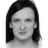
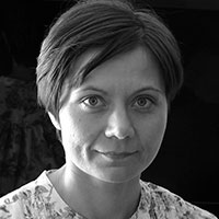
Małgorzata Jenerowicz-Sanikowska M.Sc. Eng., 2007. PhD, 2016. Her PhD dissertation has investigated the automatic feature extraction (refugee/IDP dwellings included) based on mathematical morphology operators and VHR satellite imagery. Has experience of over 10 years in Copernicus/GMES and ESA projects. Developed an operational GIS tools applied as external support for border monitoring in LIMES and G-MOSAIC project. Continued the security related analysis in a frame of BRIDGES project. Has large experience in validation and accuracy assessment of EO based products, developing the verification methodology in G-NEXT, G-SEXTNANT, Sentinel-2 Global Land Cover project (S2GLC) and BAMS-Mazovia (Built-up Areas Monitoring Service for Mazovia) project. Taking part in ESA projects activities, investigating EO data based feature extraction process, including the mathematical morphology application, supporting the development of the fully automatic method for selected crop types classification (ACCESS-4FI, no.:4000126338/19/NL/Cbi/md). Has experience of over 10 years in the IDP’s and Refugee’s camps topic related research under the geospatial analysis aspects, started in 2010 as a temporary research assistant at Joint Research Centre EC (JRC EC), performing refugees/IDPs camps analysis cooperating with World Food Programme (WFP). In 2016 she was leading the ADEMOS project in national funded programme: Polish-Norwegian Research Cooperation, developed an improved automated procedure for IDP/Refugee dwellings detection and enumeration in cooperation with JRC EC and WFP. In 2017-2020 as a postdoctoral researcher, was involved in the evaluation of the usefulness of multifractal formalism vs mathematical morphology in the processing and analysis of refugee/IDP camp areas based on VHR satellite data (project funded by National Science Centre in Poland, OPUS 12, no.:2016/23/B/ST10/01151). Currently senior researcher in Earth Observation Department at CBK PAN and the leader of the ARICA POLNOR2019 Polish-Norwegian research project financed under Norway Grants the "Applied Research" program. She is an author or co-author of publications in national and internationals journals. ORCID ID: 0000-0003-1165-0503 |
 |
Anna Wawrzaszek Ph.D. in Physics (2009), DSc (habilitation) in Earth and environmental sciences (2020), currently professor CBK PANShe has extensive experience with various data analysis techniques for measurements from several spacecraft missions (Helios, ACE, Ulysses, Voyager, Themis), as well as for satellite imagery (EROS-A, WorldView-2, GeoEye-1, IKONOS, Pléiades). In particular, her research interests include advanced multifractal parameters and their application to the processing and analysis of large multidimensional datasets. She has been involved in a number of scientific projects: 7 national projects founded by MNiSW or NCN, two FP7 projects (ULISSE no 218815, STORM 313038), as well as ESA (4000116953/16/NL/Cbi) and NCBiR (POIR.01.01.01-00-0024/17-00) projects related to the development of space technology. She was also a member of the team working on the launch of the first Polish scientific satellites (the BRITE-PL project), which currently has two satellites in orbit (project no. 427/FNiTP/78/2010 founded by MNiSW). She is the author/co-author of more than 40 scientific articles, 6 invited talks, more than 70 conference abstracts. ORCID ID: 0000-0001-9946-3547 |
 |
Ewa Gromny M. Sc. Eng. in 2015 - Geodesy and Cartography at Military University of Technology in Warsaw specialising in Photogrammetry, Remote Sensing and Geographic Information System. She has been working for five years as a geomatics analyst in Earth Observation Group in CBK PAN. Has experience in various Copernicus, European Commission and ESA projects. Involved for three years in Sentinel-2 Global Land Cover project (S2GLC) project founded by ESA which aim was to elaborate and examine available methods for classification of Sentinel-2 data to create a prototype of land cover data base on a global scale and also to investigate the capabilities of Sentinel-2 data usage itself. Land Cover map of Europe for 2017 with 10 m resolution has been created as a result of the extension of the S2GLC project. Recently took part in part of Sat4Envi project which aim was to create an operating system for flood detection in Poland using Sentinel-1 data. She has been working with both satellite and aerial images, especially focusing on land cover classification, post-processing of classification results and change detection analysis. ORCID ID: 0000-0003-3065-5203 |
 |
Sebastian Aleksandrowicz PhD. Eng. (M.Sc. Eng. in 2007 at Military University of Technology in Warsaw, PhD in engineering and technology at the AGH University of Science and Technology, Kraków, Poland in 2019) geomatics specialist at CBK PAN, employee of Earth Observation Department is responsible for the development of pixel based and object based image classification and change detection methods, data processing including atmospheric correction and image orthorectification. Has over 12 years’ experience in Copernicus/GMES, ESA and Polish Science Centre projects. He is responsible for research on use of multifractals for change detection. He was responsible for the preparation of tool for automatic global burnt areas detection on Landsat, Sentinel-2 and MODIS images in the AF3 project. Prepared change detection tool used in Geoland2/SATChMo project funded by EU within FP7 program. Was responsible for the preparation and implementation of validation and verification procedures in G-NEXT and G-SEXTANT (FP7) |

