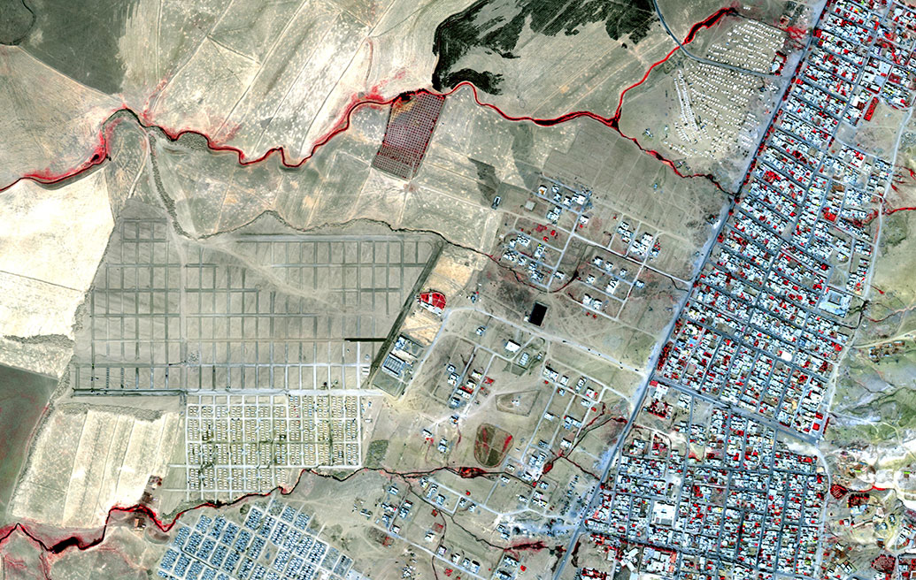
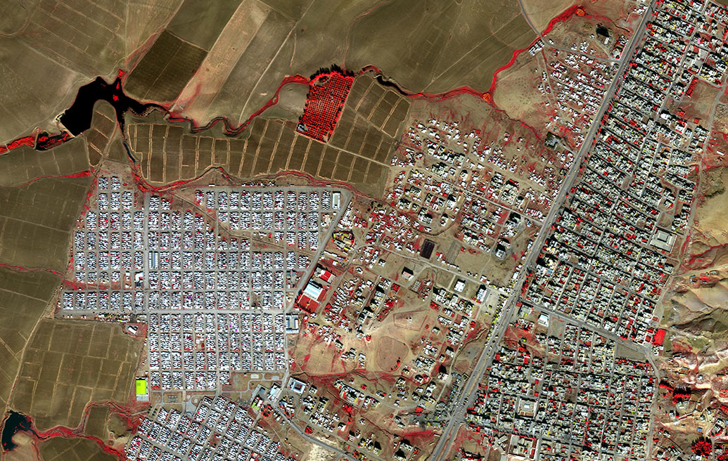
Satellite images taken six years apart (2014 and 2020) show the land cover changes in the area of Khanke IDP (internally displaced people) camp in Iraq.
The size of the camp increased from 680 000 m2 in 2014 to 775 000 m2 today.
Dataset: multispectral pansharpened images, 0.5m spatial resolution, false colour composition (NIR, R, G), where red color indicates healthy vegetation.
SEPTEMBER 2014
NOVEMBER 2020
Data source: DigitalGlobe WWW Reference: http://www.digitalglobe.com